
20-6-21.
IN STOCK.
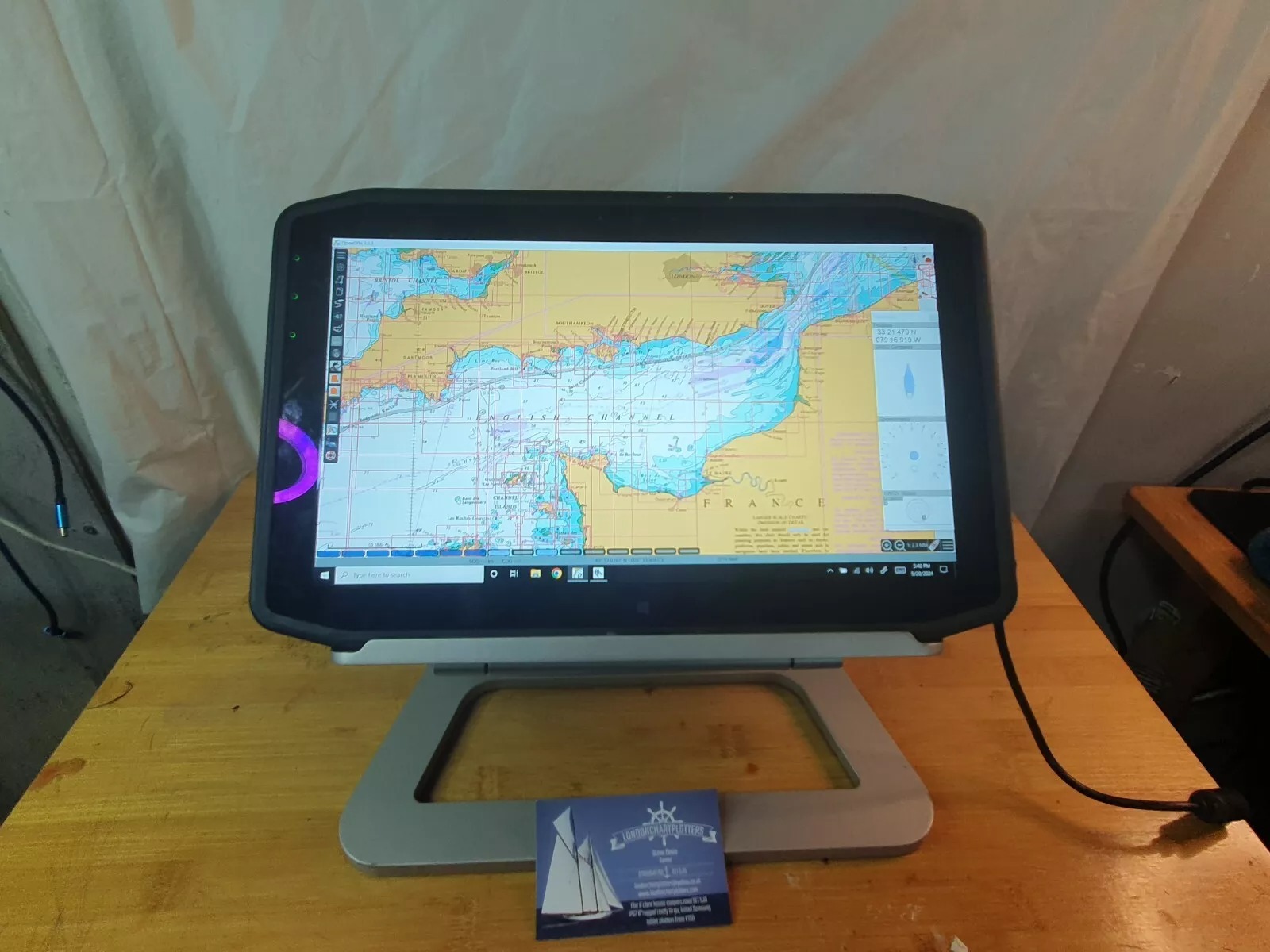
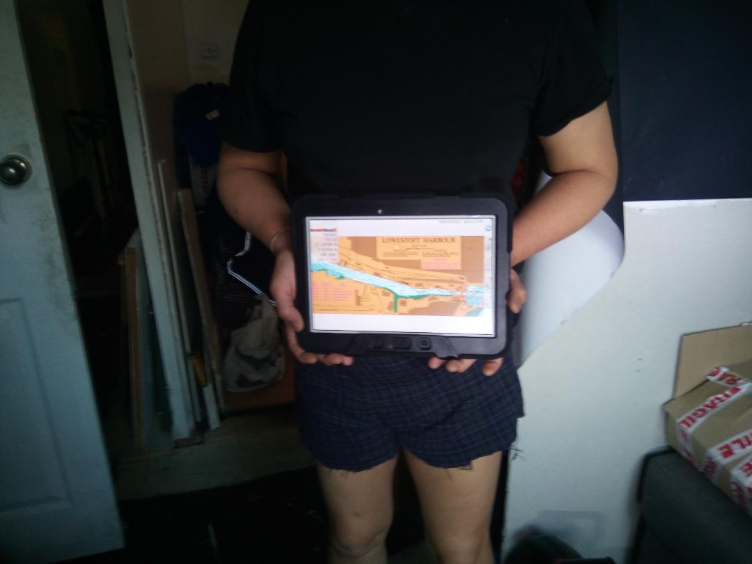
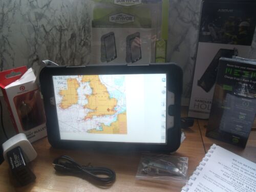
SAMSUNG 10.1 REFURB TAB4/TAB3 TABLET CHARTPLOTTERS
websales will get the best one available.
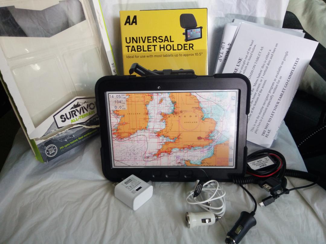
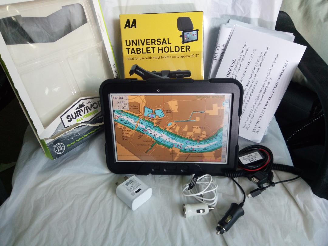
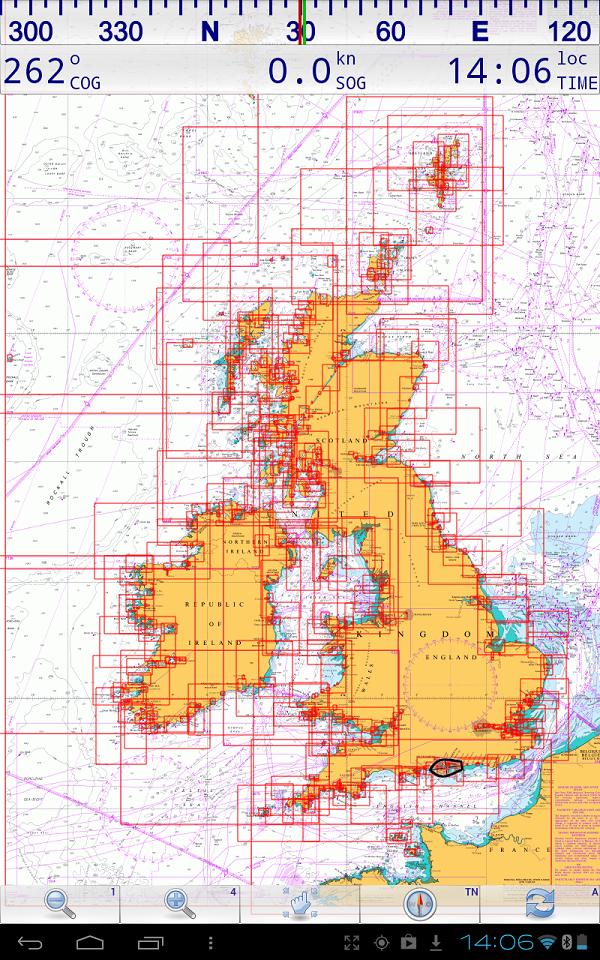
FULL UK CHARTS FULL KIT.
REDUCED twice NOW
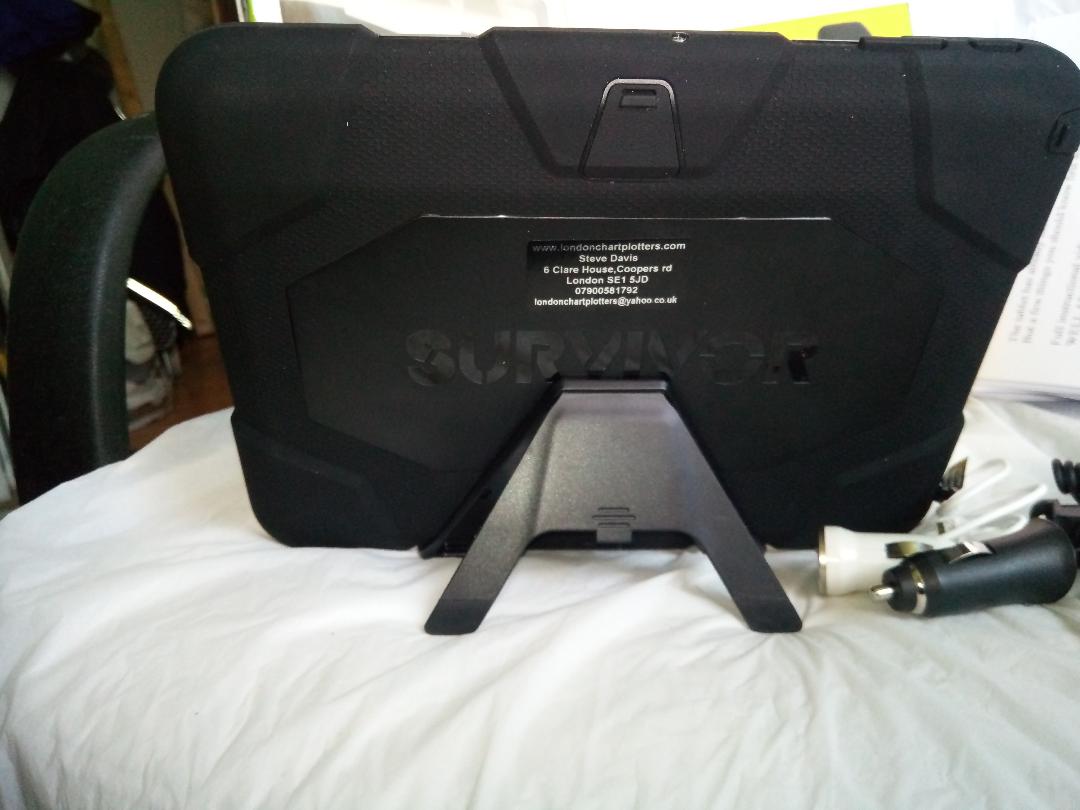
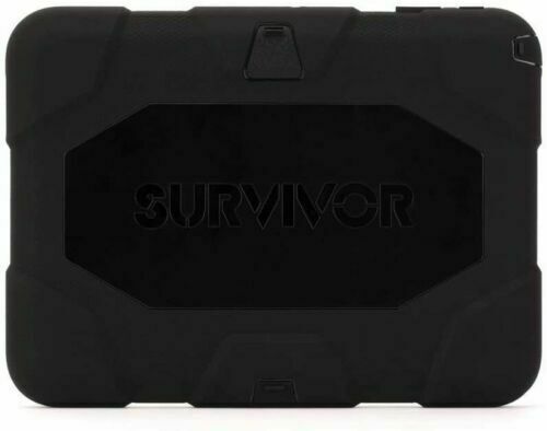
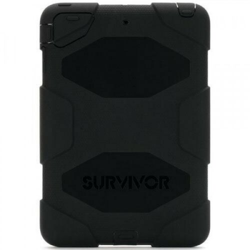
WITH GRIFFIN SURVIVOR PROTECTOR CASE.IP55. MILITARY STANDARDS MIL-STD810G
STAND HAS THE OPTION OF FIXING THE HOLDER BAR BY GLUE.SCREW/BOLT OR THE CLAMPS...MUCH LESS WOBBLE...DOESNT BREAK OFF AS THE SUCTION ONES CAN DO.
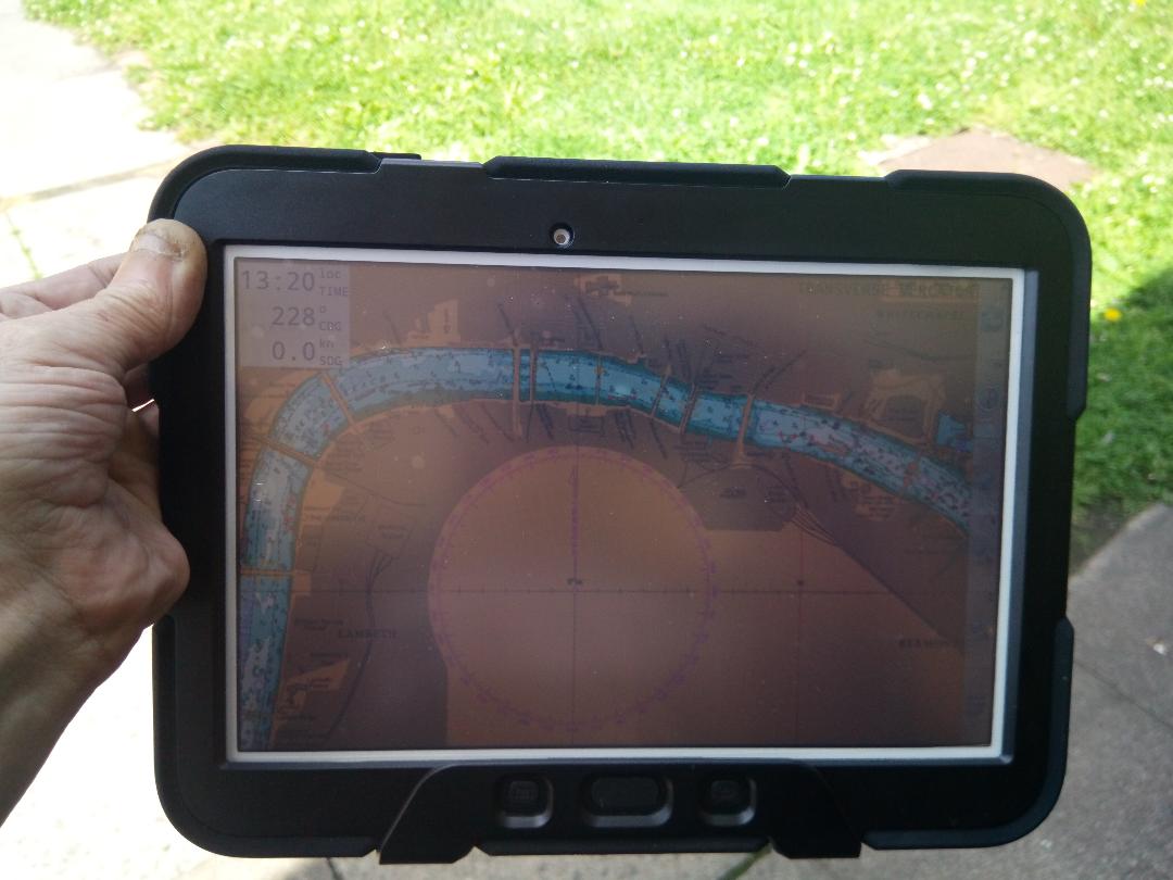
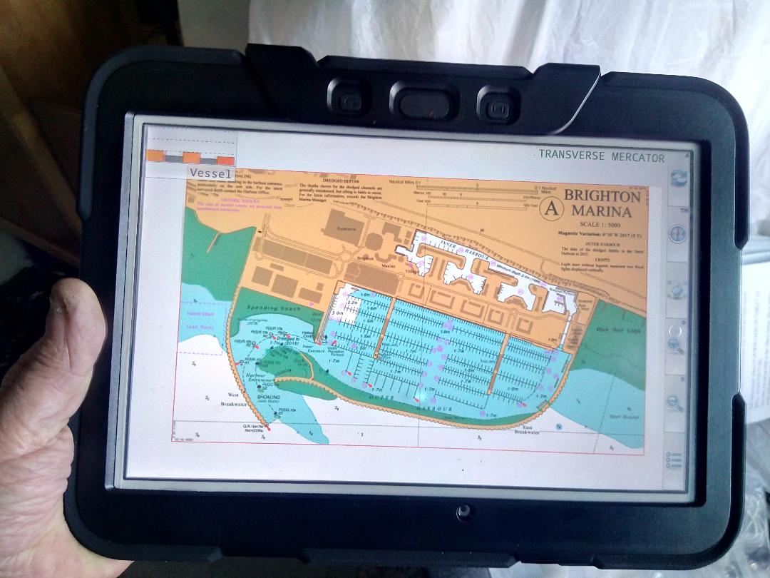
FULL KIT...FULL 2021 UK AND IRE CHARTS,12V AND 240 CHARGERS,HIGH QUALITY STAND,CLAMP.DAYLIGHT VIEWABLE SCREEN
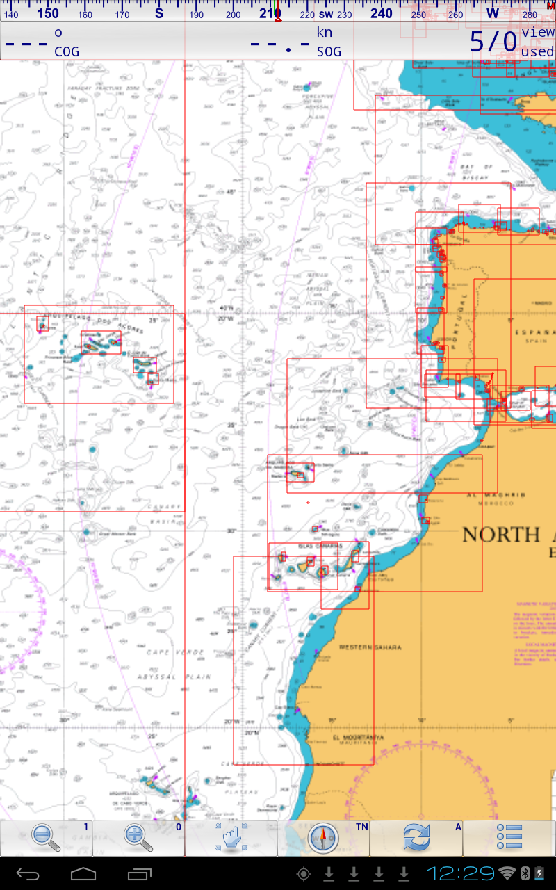
THIS ALSO HAS NON 2020 out of date CHARTS FOR NEAR CONTINENT.SEE PICTURE FOR THIS HUGE COVERAGE
1280x 800 pixel LCD touch-screen display – no scratches
4GB RAM, 16GB storage
microSD card slot
GPS/ GLoNASS satellite positioning
3MP front camera, 1.3MP rear camera
1.2GHz Quad Core processor
Full HD playback & HD recording
Bluetooth, WiFi, ANT+, apt csr
Android 5.0.2
FULL SET OF 883 2021 LICENCED AND LEGAL UK CHARTS..GREAT DETAILED COVERAGE,
NON GOOGLE PLAY O.E.M. LATEST MARINE NAVIGATOR LICENCED APP INSTALLED WITH THE CHARTS.SOFWARE MANUAL IS INCORPORATED IN HELP WHEN YOU OPEN MARINE NAVIGATOR.A SHORT DEMO VIDEO IS PUBLISHED BY US ON YOU TUBE....SEARCH LONDONCHARTPLOTTERS.
The Charts:
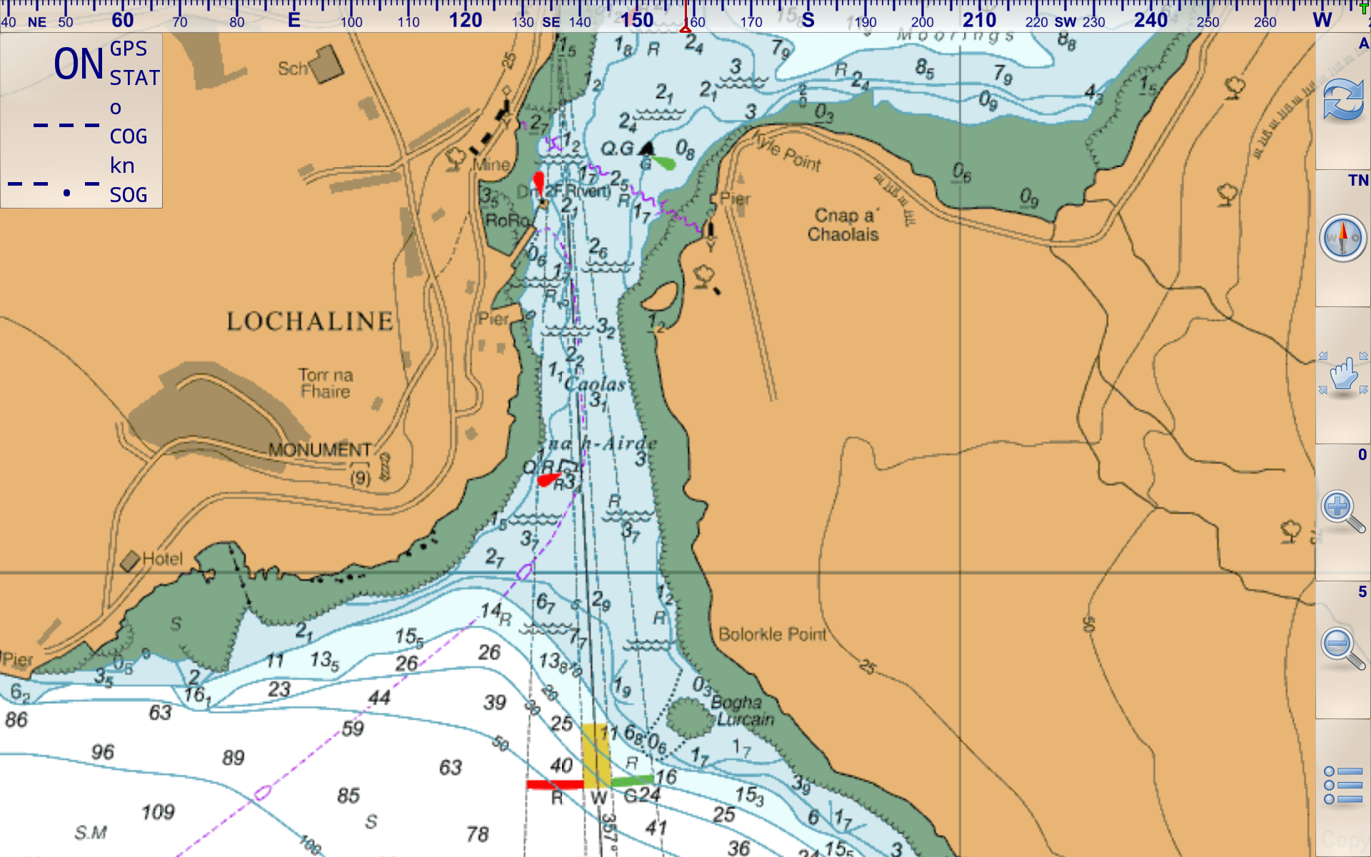
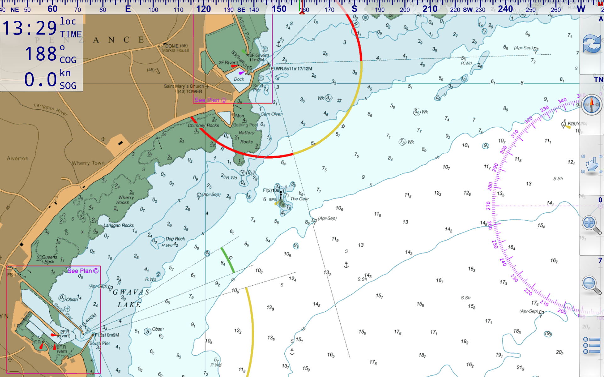
Made from standard raster charts. You just can't beat the superb detail of raster charts. Vector charts do not have the richness of detail, but are seamless. At VMH we prefer raster every time.
From a white paper by CherSoft, the company who produce "Easy Tide" for the UKHO. For a full understanding of the differences between RASTER and VECTOR charts download the white paper
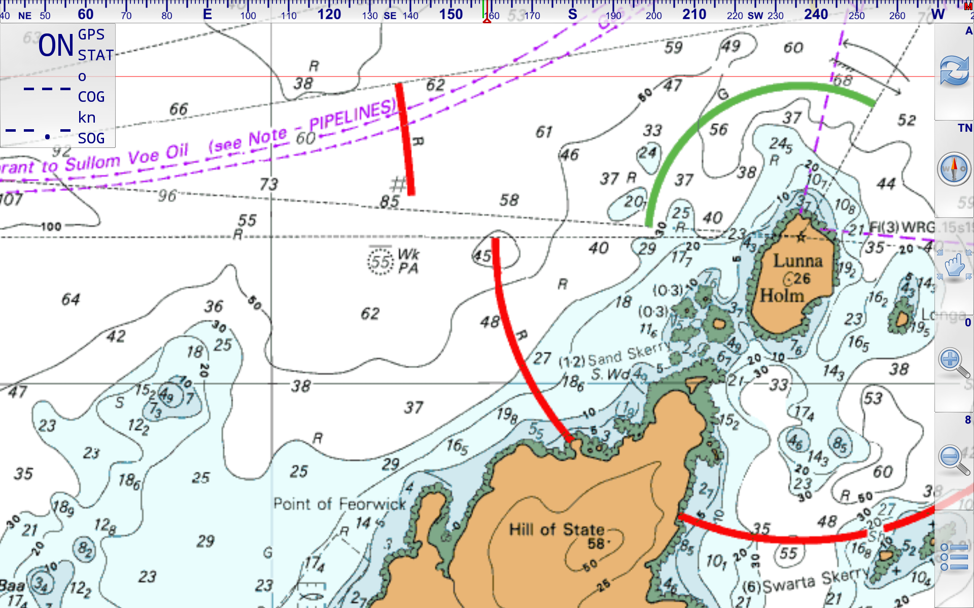
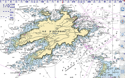
Tap/Click thumbnails to see large image

Tap/Click thumbnails to see large image


Tap/Click thumbnails to see large image
When used with appropriate charts, the app can be used as a stand alone portable chartplotter using the Android tablets' built in GPS (and compass if present). Routes, waypoints and tracks can be used and saved. Charts can be dragged around and switch automatically on zooming in/out.
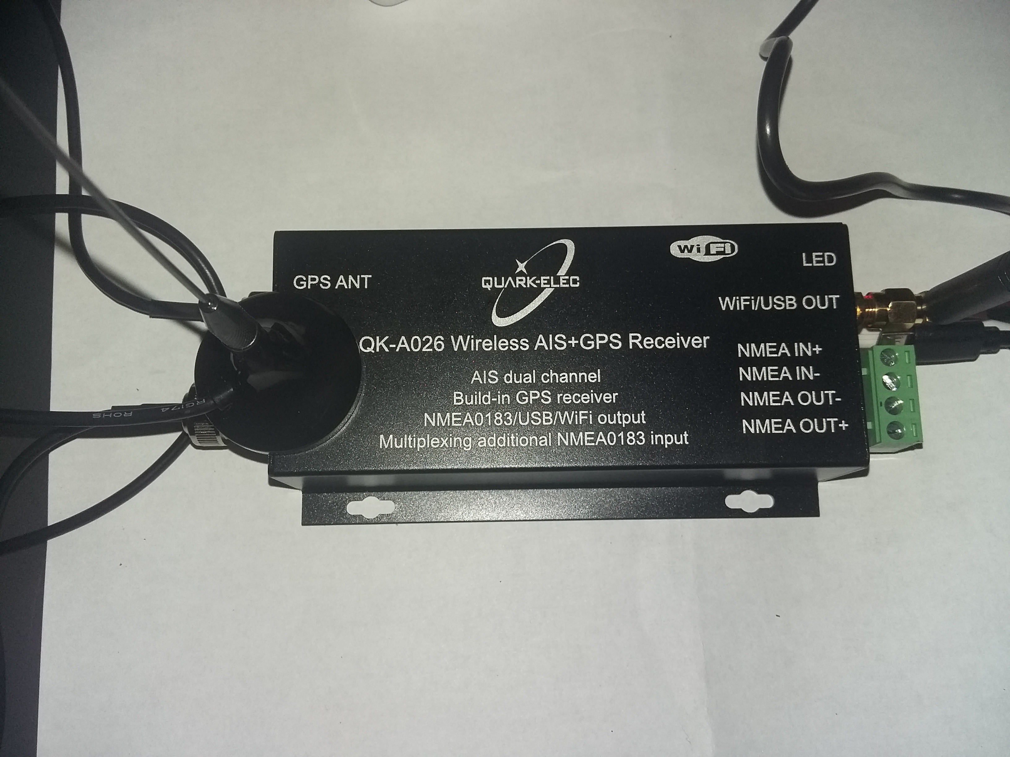
AIS function has just been added with an in app upgrade to ongoing AIS capability. NMEA feed for AIS targets needs to be delivered by wifi network. Small AIS units that provide this are available cheaply, well under £100.
Existing users of the app, can update to the "new" version via the Play Store (without charge) to experiment with the AIS function. Existing working VMH chartsets will be unaffected by this app update.
.
Why use an Android tablet ?
Because if you get a decent tablet with 10" screen , and built in GPS and compass using these charts in conjunction with "Marine Navigator" app (buy for about £6.50 in the Google Play Store) will give you a fully featured chart plotter, that's "stand alone" and complete. No connecting GPS sets, it's all there already. The charts are fully installed, no internet needed (after installation) , use at sea. Use in the cockpit or chart table. You can get waterproof protective cases for the tablet too. Long battery life, quick start up... what more could you want ? (best in our experience by far.. Sony Xperia tablet Z)
Why "Marine Navigator" ?
Because we've found it to be so easy to actually use in real seagoing situations. The designer Ronald Koenig, is responsive and continues to update his app all the time. It's versatile.. In addition to our encrypted charts, it can also use standard BSB2/3 charts you may already have. For instance Antares charts for W. Scotland. This app can even calculate routes using Great Circle (for ocean sailors) or Rhumb lines.
"Marine Navigator is an offline navigator using raster navigational charts (RNC's) to plot your position in real time. This way you can navigate with true copies of official paper charts on your mobile device. This full version of the Marine Navigator provides besides the functionality of the lite version the following enhanced functions:
* automatic chart switching depending on current position and zoom level
* scrolling through all charts available for the current location by "press and hold" zoom buttons
* display of number of available charts for current location in the zoom buttons
* display of outlines of installed charts in active chart
* chart rotation (True North, True Course, Compass Heading, original chart orientation)
* tracks, way points, routes
* follow route automatically
* intuitive route editor
* gpx import and export of waypoints and routes
* gpx export of tracks
* recording of tracks in active and standby mode
* length of recorded tracks only limited by the capacity of the external storage (SDCARD)
* compass (magnetic north, true north)
* different dashboard layouts (basic data, detailed route data, detailed GPS data including graphical status info)
* Man Over Board (MOB) functions"
Our favourite feature so far: Being able to point the tablet at the bows, "Compass Up", and having the "True Course Line" switched on. This show as a dotted line stretching ahead the CMG by the boat. So "at a glance" the navigator can see how much the current is having an effect on the boat at that instant. (Or leeway for that matter).
The "Compass Up" feature also allows you to positively identify buoys or seamarks from a distance, by lining them up with the tablet/phone.
Note: Not ALL Android devices have a built in compass.
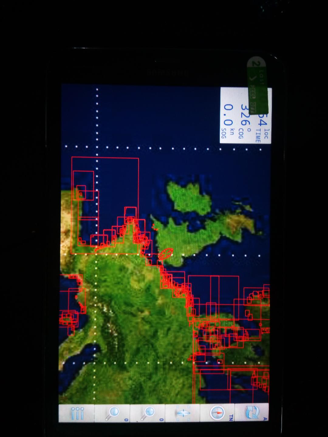
AIS screenshots
This example is using an underlying map, not a chart:
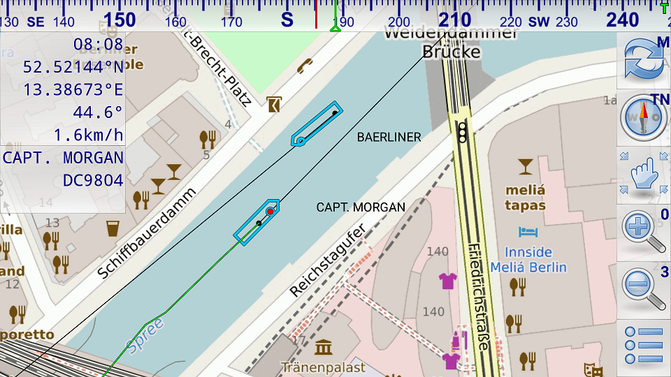
In this picture above both vessels have send position reports and static voyage related data (name of vessel, call sign, ...). The black dots show the last received position. The black lines show the predicted course. The position of the vessel is calculated based on the data of the last received position report (position, COG, SOG). The dimensions of the vessels are taken from the last received static voyage related data report. Capt. Morgan is selected therefore its detailed data are shown in the upper left corner of the screen and its track based on the previously received position reports is shown by a green trailing line. Capt. Morgan has not specified its destination. Therefore destination information is missing below the call sign.
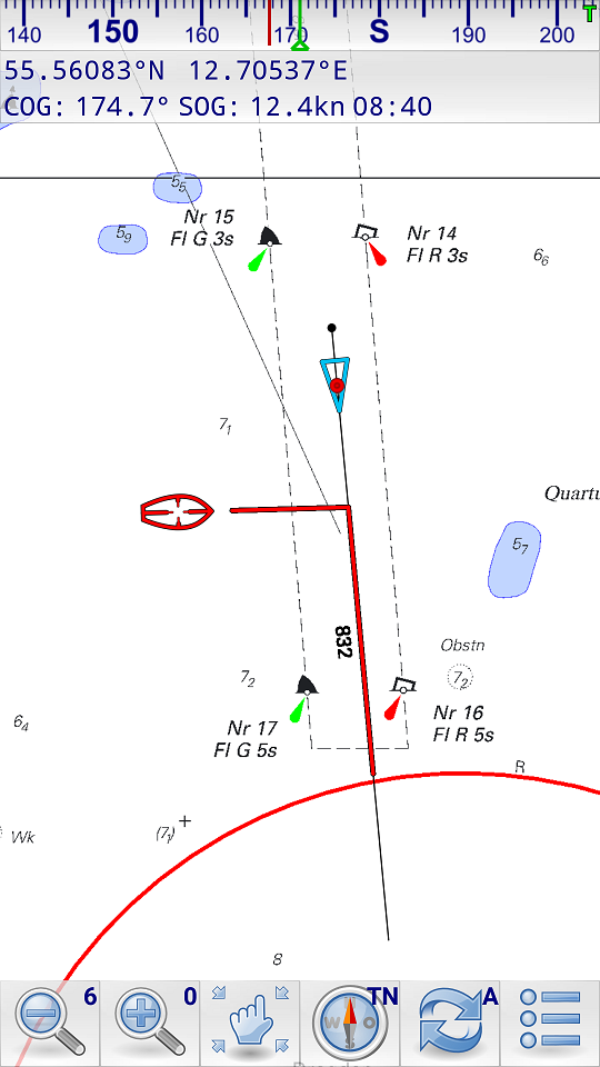
This picture above shows a collision alert. The red line on the own course line shows the passing distance when the other vessel crosses the own course line. The red line on the course line of the AIS target shows the passing distance when the own vessel crosses the course line of the AIS target. In the illustrated case the own vessel will cross 832m behind the AIS target. The AIS target (red cursor) is selected. It hasn't send any static voyage related data yet. Therefore only data of the position report is shown (position, SOG, COG).
A FEW FREE MARINE APPS INSTALLED F.O.C,,EG WEATHER/GRIB/ETC. SOME OF THESE REQUIRE A INTERNET CONNECTION.MARINE NAVIGATOR,THE NAV APP DOES NOT..
FREE 2022 UPDATE ON THE UK IRE CHARTS VIA DOWNLOAD IN FEB 2022
IF IN 2023 YOU WANTED FRESH CHARTS IT WOULD BE 14.95 AT TODAYS PRICE FOR A FULL SET OF 2023,S WITH A FREE 2024 UPDATE.
THIS IS A FULL TURNKEY SET...YOU COULD OPEN THE PACK ON THE BOAT AND GO SAILING.
THIS DOES NOT NEED INTERNET/SIM/WIFI TO NAVIGATE..IT USES GPS AND GLONAS SATTELITES...FREE... TO GET YOURE POSITION...ACCURATE TO WITHIN A COUPLE OF METERS MAX.
NO ANNUAL CHARGES..EVERYTHING PAID FOR AND UP AND RUNNING.CHARTS DO NOT STOP WORKING.NO DOWNSIDE.NO CATCHES.
UNPACK THIS ON THE BOAT AND YOU WILL BE FINE!!!!!
ALL COVERED UNDER OUR "IN HOUSE" (NO SENDING OFF) 6 MONTH GUARANTEE.EXTENDABLE TO 12 MONTHS FOR 20.00
EVEN IF YOU BREAK IT...WELE FIX IT HERE.UNDER GUARANTEE OR NOT..AT A PRICE THAT MAKES SENCE...EG SCREEN REPLACE 50.00 .SCREEN COSTS US 42.00
WE DO NOT CHARGE LABOUR FOR REPAIRS IF IT IS OUR DEVICE.ONLY COSTS.
* automatic chart switching depending on current position and zoom level
* scrolling through all charts available for the current location by "press and hold" zoom buttons
* display of number of available charts for current location in the zoom buttons
* display of outlines of installed charts in active chart
* chart rotation (True North, True Course, Compass Heading, original chart orientation)
* tracks, way points, routes
* follow route automatically
* intuitive route editor
* gpx import and export of waypoints and routes
* gpx export of tracks
* recording of tracks in active and standby mode
* length of recorded tracks only limited by the capacity of the external storage (SDCARD)
* compass (magnetic north, true north)
* different dashboard layouts (basic data, detailed route data, detailed GPS data including graphical status info)
* Man Over Board (MOB) functions"
Our favourite feature so far Being able to point the tablet at the bows, "Compass Up", and having the "True Course Line" switched on. This show as a dotted line stretching ahead the CMG by the boat. So "at a glance" the navigator can see how much the current is having an effect on the boat at that instant. (Or leeway for that matter).
The "Compass Up" feature also allows you to positively identify buoys or seamarks from a distance, by lining them up with the tablet/phone.
Note: Not ALL Android devices have a built in compass.
AIS screenshots
This example is using an underlying map, not a chart:
position reports is shown by a green trailing line. Capt. Morgan has not specified its destination. Therefore destination information is missing below the call sign.
This picture above shows a collision alert. The red line on the own course line shows the passing distance when the other vessel crosses the own course line. The red line on the course line of the AIS target shows the passing distance when the own vessel crosses the course line of the AIS target. In the illustrated case the own vessel will cross 832m behind the AIS target. The AIS target (red cursor) is selected. It hasn't send any static voyage related data yet. Therefore only data of the position report is shown (position, SOG, COG).
p
- The Griffin Survivor is designed to meet American military standards. The silicone jacket cushions shocks and falls from a height of up to 1.8m
- Dirt, sand, rain, shocks and vibrations, the Survivor can withstand the most extreme conditions. All ports and buttons remain accessible through the cover
- A shatter-proof polycarbonate frame and a shock-absorbing silicone cover protect your tablet perfectly. The integrated, scratch-resistant protective film also protects your screen from damage.
- The detachable stand allows you to conveniently watch videos, write emails or present emails.
- Box contents: Griffin Survivor All Terrain case for Samsung Tab 4 10.1"
Sturdy. Tough. Protected.
Griffin designed and rigorously tested Survivor All-Terrain to be the most protective case possible for whatever your day has in store.
Built from the inside out to meet or exceed the standards published in US Department of Defence MIL-STD-810G, Survivor All-Terrain protects your tablet from extreme conditions, including drops, dust, sand, rain, impacts, vibration, and a host of other environmental factors.
Snug fit won't affect use
All Terrains thickness and snug button covers don't compromise sound — it's designed with an audio-transparent, water-resistant speaker and microphone covers, as well as an Apple pencil holder.
All Terrains thickness and snug button covers don't compromise sound — it's designed with an audio-transparent, water-resistant speaker and microphone covers, as well as an Apple pencil holder.
Drop protection
The one-piece shell snaps on easily and provides protection for your tab from drops — tested & proven MIL-STD 810G.
The one-piece shell snaps on easily and provides protection for your tab from drops — tested & proven MIL-STD 810G.
Withstands every element
Rated IP55 against mud, rain, snow and sand that can damage your iPhone. The sealed design prevents screen and body damage from whatever the weather may throw at you.
Rated IP55 against mud, rain, snow and sand that can damage your iPhone. The sealed design prevents screen and body damage from whatever the weather may throw at you.
One colour suits all
Made using the toughest durable plastics, Survivor All Terrain comes in classic Black.
Made using the toughest durable plastics, Survivor All Terrain comes in classic Black.